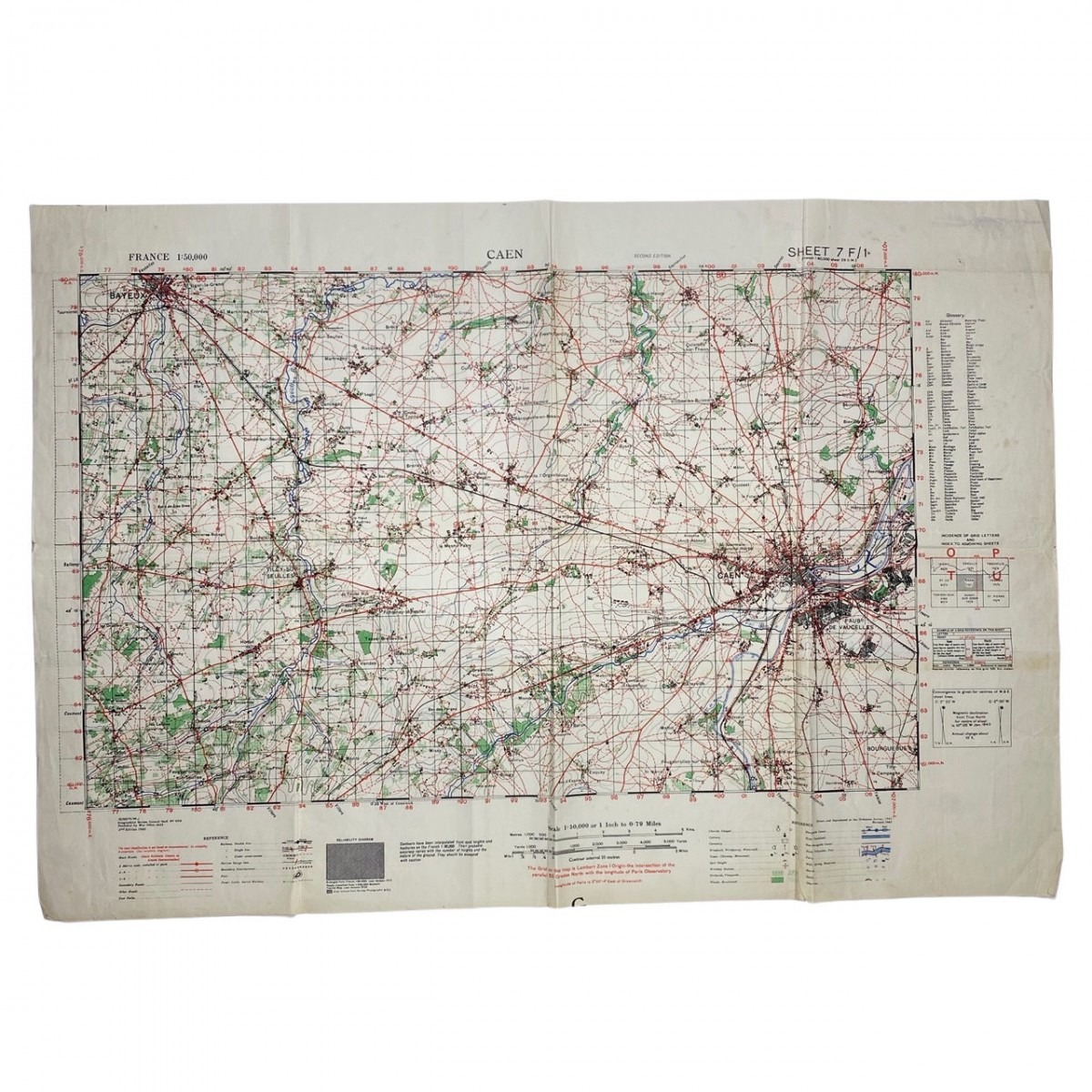
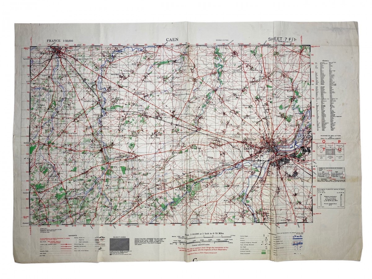
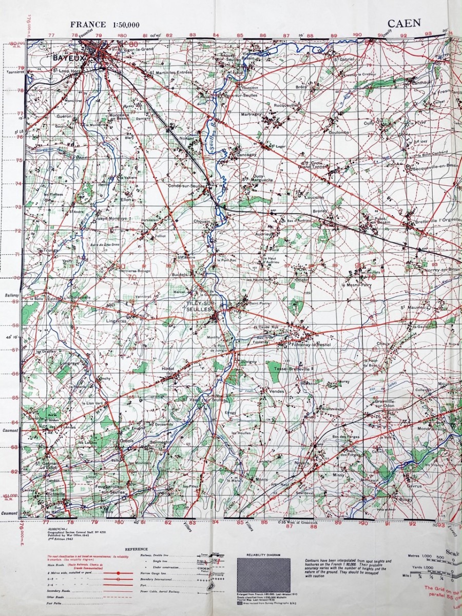
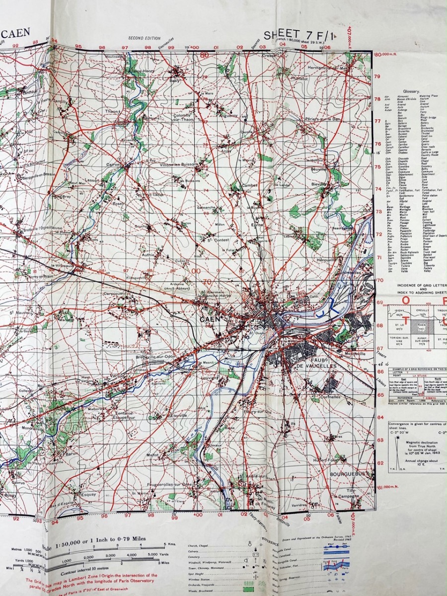
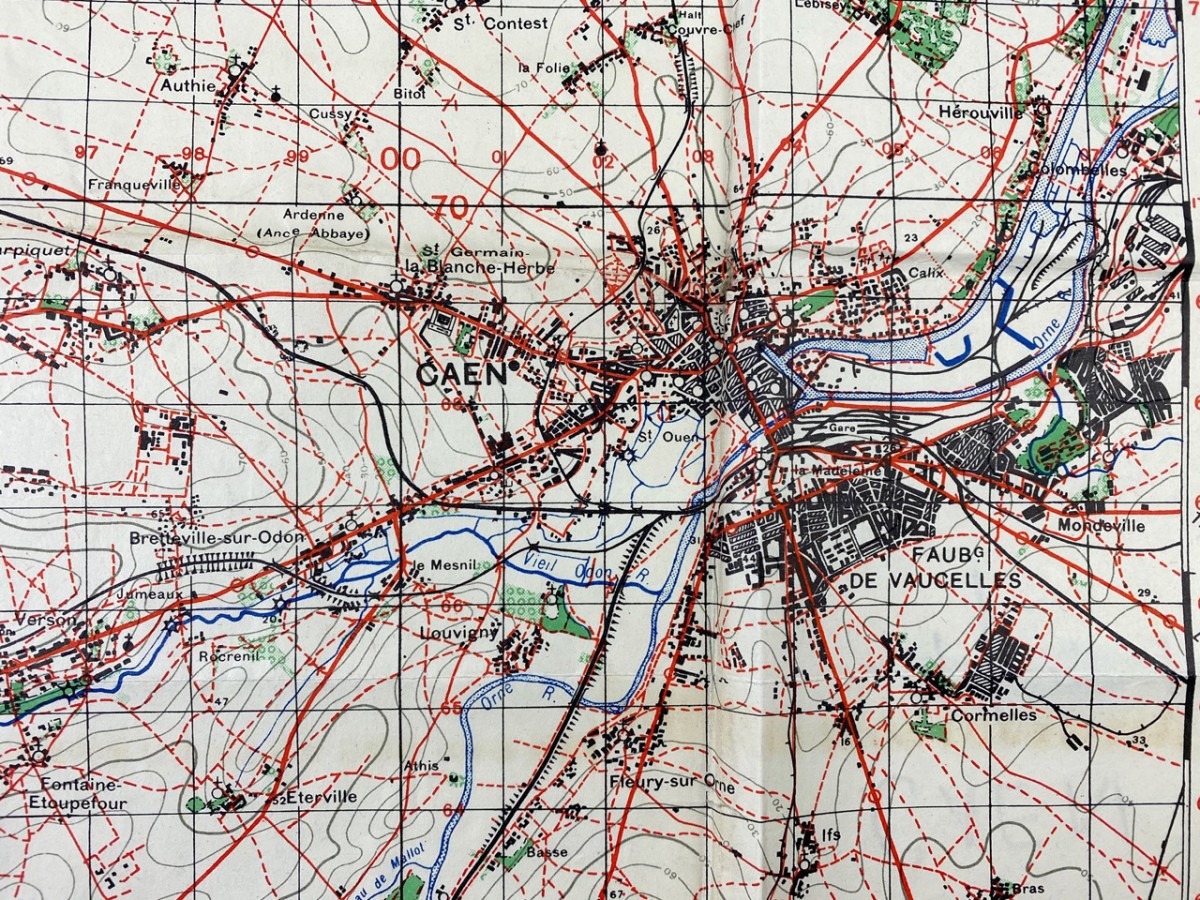
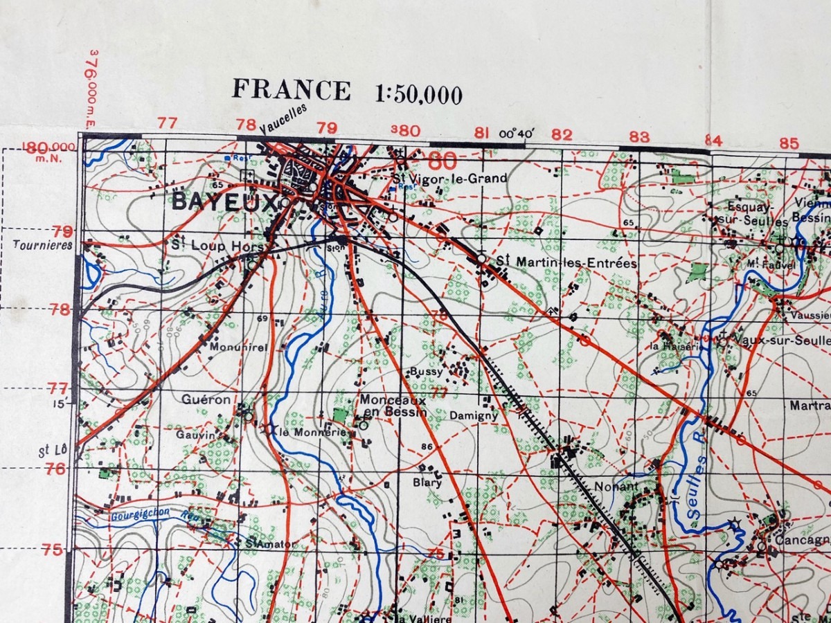
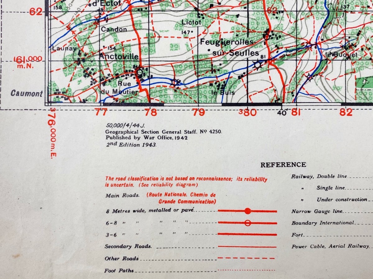
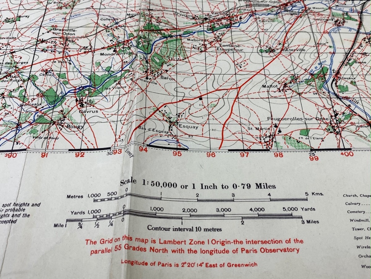
Original WWII British military map ‘Normandy – Caen’ 1943
200 €
The map is in good condition and was produced by the British war office in 1943.
It shows the area of Cean and Bayeux in Normandy.
Measurements: 77,5 x 54 cm.
A rare map for the World War II or D-Day collection!
Article number: 5441
Originele WWII Britse militaire stafkaart ‘Normandië – Caen’ 1943
De stafkaart is in een goede conditie en werd gedrukt door de Britse war office in 1943.
Op de kaart is het gebied van Caen en Bayeux in Normandië (Frankrijk) te zien.
Afmetingen: 77,5 x 54 cm.
Een zeldzame kaart voor de Tweede Wereldoorlog of D-Day collectie!
Artikelnummer: 5441
Out of stock