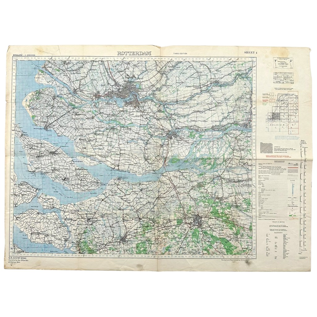
Original WWII British large size map of the area of Rotterdam in 1944
75 €
This large-format British Army map is in good condition and shows the city of Rotterdam and the surrounding area.
The map dates from 1944 and also features locations such as Dordrecht, Papendrecht, Breda, Moerdijk, Gorinchem, Vlaardingen and Schiedam.
Dimensions: 88.5 x 65 cm.
An interesting map for any military or Second World War collection!
Article number: 19395
Originele WWII Britse leger groot formaat kaart Rotterdam en omgeving in 1944
Deze groot format Britse leger kaart is in goede conditie en daarop is de stad Rotterdam met omliggend gebied op te zien.
De kaart dateert uit 1944 en ook locaties zoals Dordrecht, Papendrecht, Breda, Moerdijk, Gorinchem, Vlaardingen, Schiedam.
Afmetingen: 88,5 x 65 cm.
Een interessante kaart voor militaria of Tweede Wereldoorlog collectie!
Artikelnummer: 19395
Out of stock