Original WWII German 8th Panzer Division Campaign Map – Western Campaign France & Belgium 10 May–25 June 1940
75 €
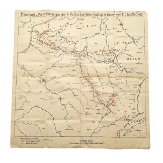
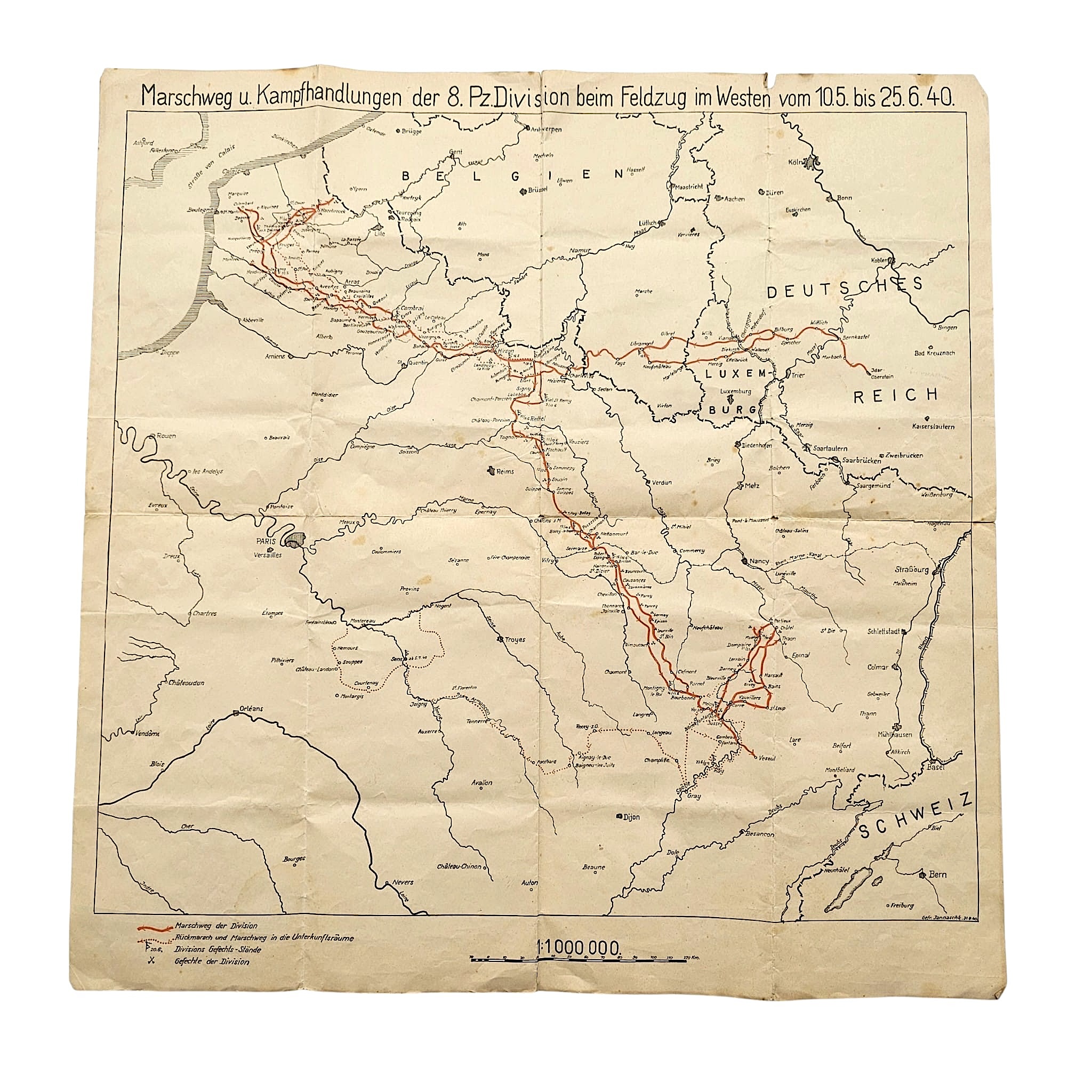
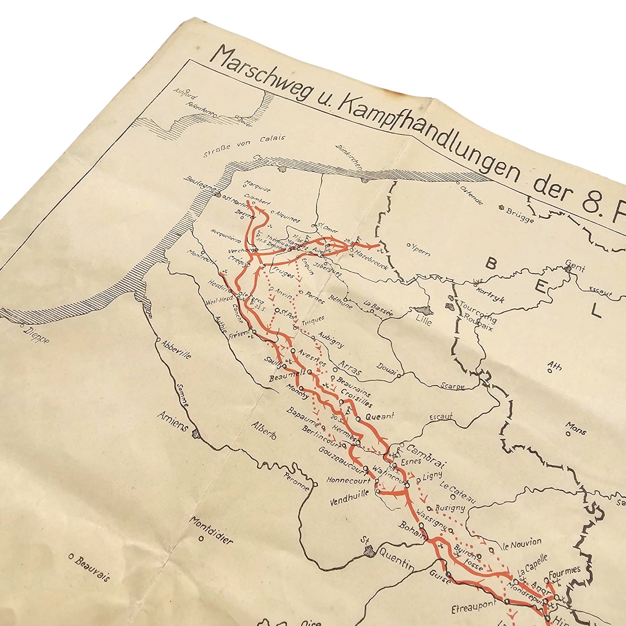
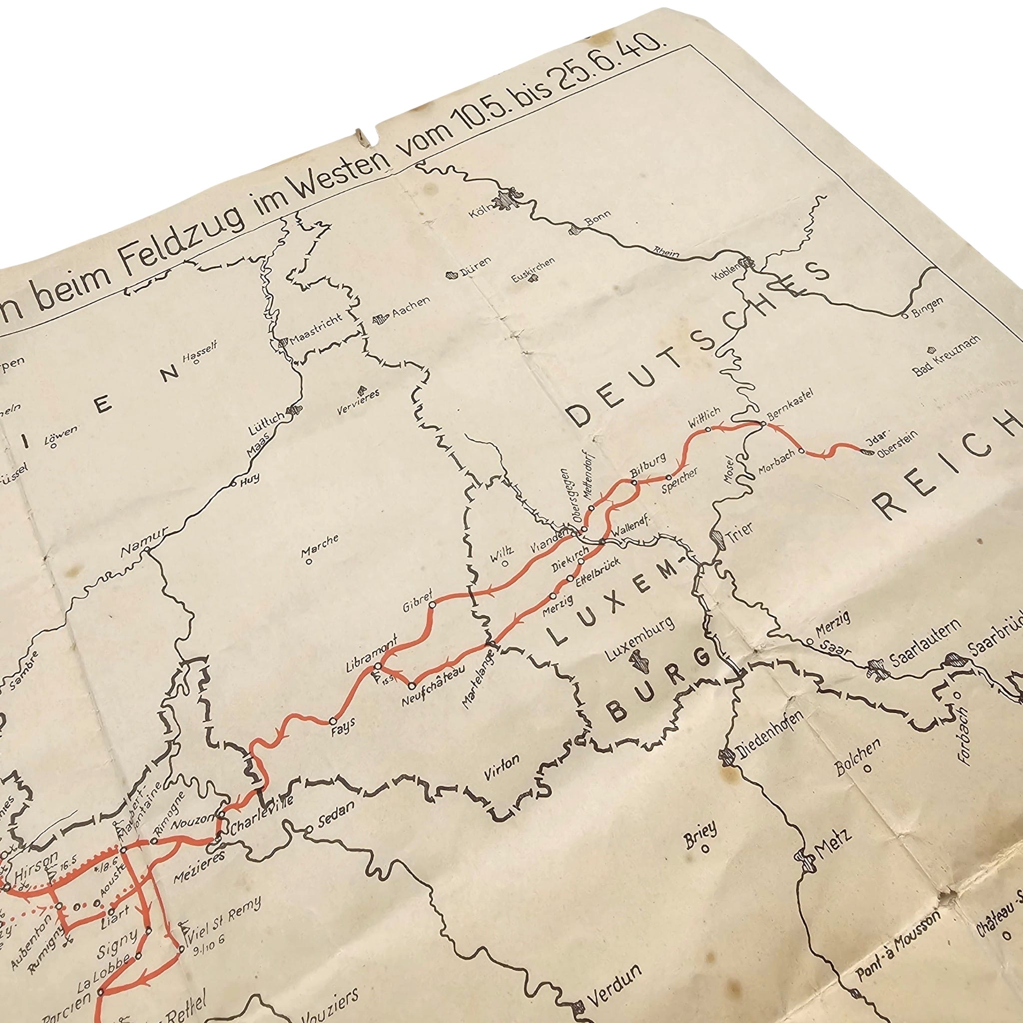
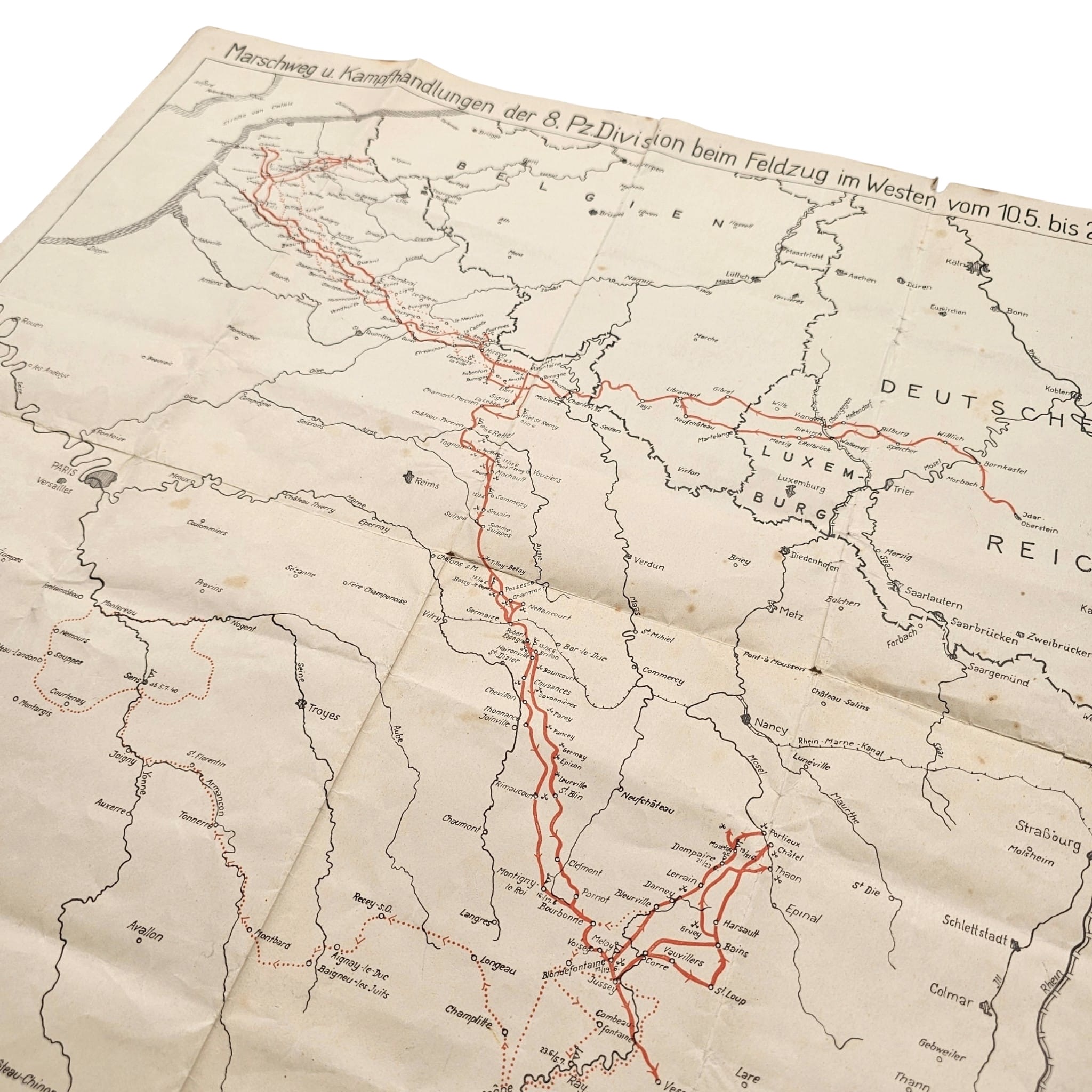
Original WWII German campaign map of the 8th Panzer Division titled ‘Marschweg u. Kampfhandlungen der 8. Pz.Division beim Feldzug im Westen vom 10.5. bis 25.6.40’.
The map documents the marching route and combat operations of the German 8th Panzer Division during the Western Campaign between 10 May and 25 June 1940.
The 8th Panzer Division participated in the German offensive in the West from 10 May 1940 and advanced from Germany through Luxembourg, Belgium and northern France before continuing deeper into France.
The division’s route is marked in red, showing its movements, various combat locations and operational movements during the campaign.
The route begins in Germany around Idar-Oberstein and continues through locations including Wittlich, Bitburg and Wallendorf towards Luxembourg.
The advance then continues through locations including Neufchâteau, Libramont, Fays, Charleville, Mézières, Signy, La Capelle and the Cambrai area.
In northern France the map records extensive movements and combat operations around Cambrai, Arras, Béthune, Saint-Omer, Hazebrouck, Aire and Montreuil, extending towards the Channel coast near Boulogne and Calais.
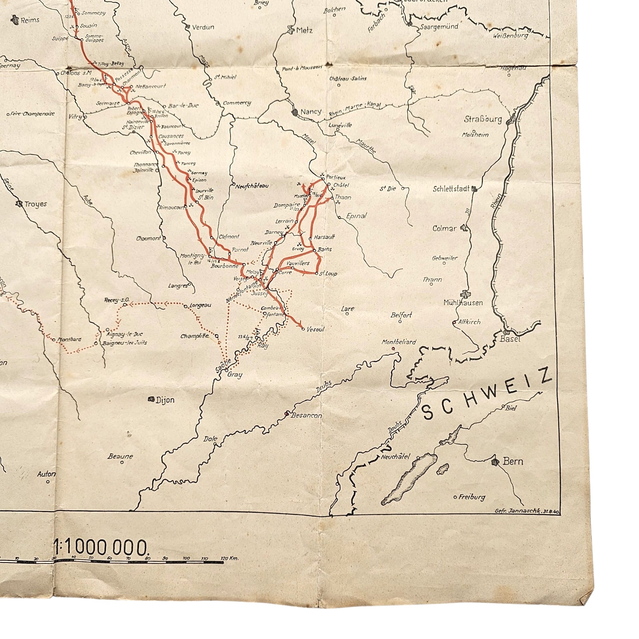
The subsequent advance south is shown through locations including Reims, Châlons-sur-Marne, Bar-le-Duc and Chaumont, continuing towards the Épinal, Vittel, Vauvillers and Vesoul areas.
The legend distinguishes between ‘Marschwege der Division’, ‘Rückmarsch und Marschweg in die Unterkunftsräume’, ‘Divisions Gefechts-Stände’ and ‘Gefechte der Division’.
The map therefore provides a detailed visual record of the movements and combat activities of a specific German armoured division during almost the entire Western Campaign of May and June 1940.
Printed at a scale of 1:1,000,000, the map covers large areas of Germany, Luxembourg, Belgium and France, with parts of the Netherlands and Switzerland also visible.
The lower right corner is marked ‘Gefr. Jannasch M. 31.8.40’, dating the map to 31 August 1940 and apparently identifying Gefreiter Jannasch as its draftsman or compiler.
An interesting historical document for collectors of German Panzerwaffe, 8th Panzer Division, Western Campaign 1940 and Second World War military maps.
Article number: 21102
Originele WWII Duitse stafkaart van de 8. Panzer-Division met als titel ‘Marschweg u. Kampfhandlungen der 8. Pz.Division beim Feldzug im Westen vom 10.5. bis 25.6.40’
De kaart documenteert de marsroute en gevechtshandelingen van de Duitse 8. Panzer-Division tijdens de Westfeldzug tussen 10 mei en 25 juni 1940.
De 8. Panzer-Division nam vanaf 10 mei 1940 deel aan de Duitse aanval in het Westen en trok vanuit Duitsland via Luxemburg, België en Noord-Frankrijk verder Frankrijk binnen.
Op de kaart is de route van de divisie in rood aangegeven, waarbij zowel de marsbewegingen als verschillende gevechtslocaties en operationele bewegingen zijn ingetekend.
De route begint in het Duitse gebied rond Idar-Oberstein en loopt onder meer via Wittlich, Bitburg en Wallendorf richting Luxemburg.
Vervolgens is de opmars via plaatsen als Neufchâteau, Libramont, Fays, Charleville, Mézières, Signy, La Capelle en het gebied rond Cambrai weergegeven.
In Noord-Frankrijk toont de kaart uitgebreide bewegingen en gevechtshandelingen in het gebied van Cambrai, Arras, Béthune, Saint-Omer, Hazebrouck, Aire, Montreuil en richting de Kanaalkust bij Boulogne en Calais.
Daarna is de verdere route van de 8. Panzer-Division naar het zuiden zichtbaar via onder meer Reims, Châlons-sur-Marne, Bar-le-Duc, Chaumont en het gebied richting Épinal, Vittel, Vauvillers en Vesoul.
De legenda onderscheidt de ‘Marschwege der Division’, ‘Rückmarsch und Marschweg in die Unterkunftsräume’, ‘Divisions Gefechts-Stände’ en de ‘Gefechte der Division’.
Hierdoor vormt de kaart een gedetailleerd overzicht van de bewegingen en gevechtsactiviteiten van één specifieke Duitse pantserdivisie gedurende vrijwel de volledige Westfeldzug van mei en juni 1940.
De kaart heeft een schaal van 1:1.000.000 en toont grote delen van Duitsland, Luxemburg, België en Frankrijk, met tevens Nederland en Zwitserland aan de randen van het kaartbeeld.
Rechtsonder staat de aanduiding ‘Gefr. Jannasch M. 31.8.40’, waarmee de kaart op 31 augustus 1940 is gedateerd en vermoedelijk wordt verwezen naar Gefreiter Jannasch als tekenaar of samensteller.
Een bijzonder historisch document voor verzamelaars van Duitse Panzerwaffe, 8. Panzer-Division, Westfeldzug 1940 en militaire kaarten uit de Tweede Wereldoorlog.
Artikelnummer: 21102
Op voorraad