Original WWII US D-Day secret ‘Omaha beach’ assault plan map with brochure
3.500 €
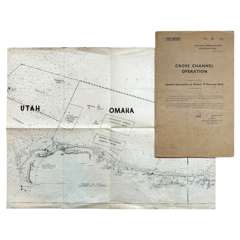
This American secret D-Day assault plan is in good condition and consists of an “Omaha beach” landing map and a US Navy manual containing the instructions for the Normandy invasion and it dates from May 10, 1944, just about three weeks before the invasion began.
The map shows the landing zone at Omaha beach and places such as Vierville, Colleville and St. Honorine are visible along with all the landing zones.
The “Operation Neptune” brochure is number 515 and we suspect that about 600 were ever made.
The brochure contains all kinds of instructions regarding the D-Day landing, for firing smoke screens, attacking aircraft and recognition and much more.
Also contains a few loose sheets of information.
The map we have never seen before!
Map dimensions: 56 x 43 cm.
A unique set for the D-Day or Normandy collection!
Article number: 13850
Origineel WWII US D-Day ‘Omaha beach’ geheim aanvalsplan kaart met handleiding 1944
Dit Amerikaanse geheime D-Day aanvalsplan is in goede conditie en bestaat uit een ‘Omaha beach’ landingskaart en een US Navy handleiding met daarin de instructies voor de invasie in Normandië en het dateert van 10 mei 1944, slechts zo’n drie weken voor de invasie begon.
Op de kaart is de landingszone bij Omaha beach te zien en plaatsen zoals Vierville, Colleville en St. Honorine zijn zichtbaar met daarbij alle landingszones.
De ‘Operation Neptune’ brochure betreft nummer 515 en wij vermoeden dat er zo’n 600 ooit van gemaakt zijn.
In de brochure staan allerlei instructies mbt de D-Day landing, voor het afvuren van rookgordijnen, aanvallen van vliegtuigen en herkenning en nog veel meer.
Tevens bevat een paar losse sheets met informatie.
De kaart hebben wij nooit eerder gezien!
Afmetingen kaart: 56 x 43 cm.
Een unieke set voor de D-Day of Normandië collectie!
Artikelnummer: 13850
Out of stock


