Original WWII US army poster of the German R-Mine 43 anti-tank mine
50 €
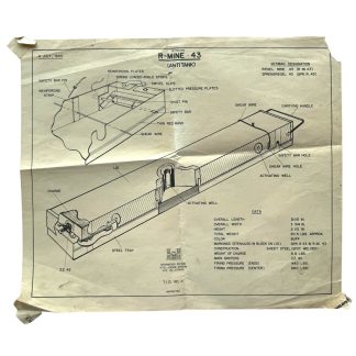
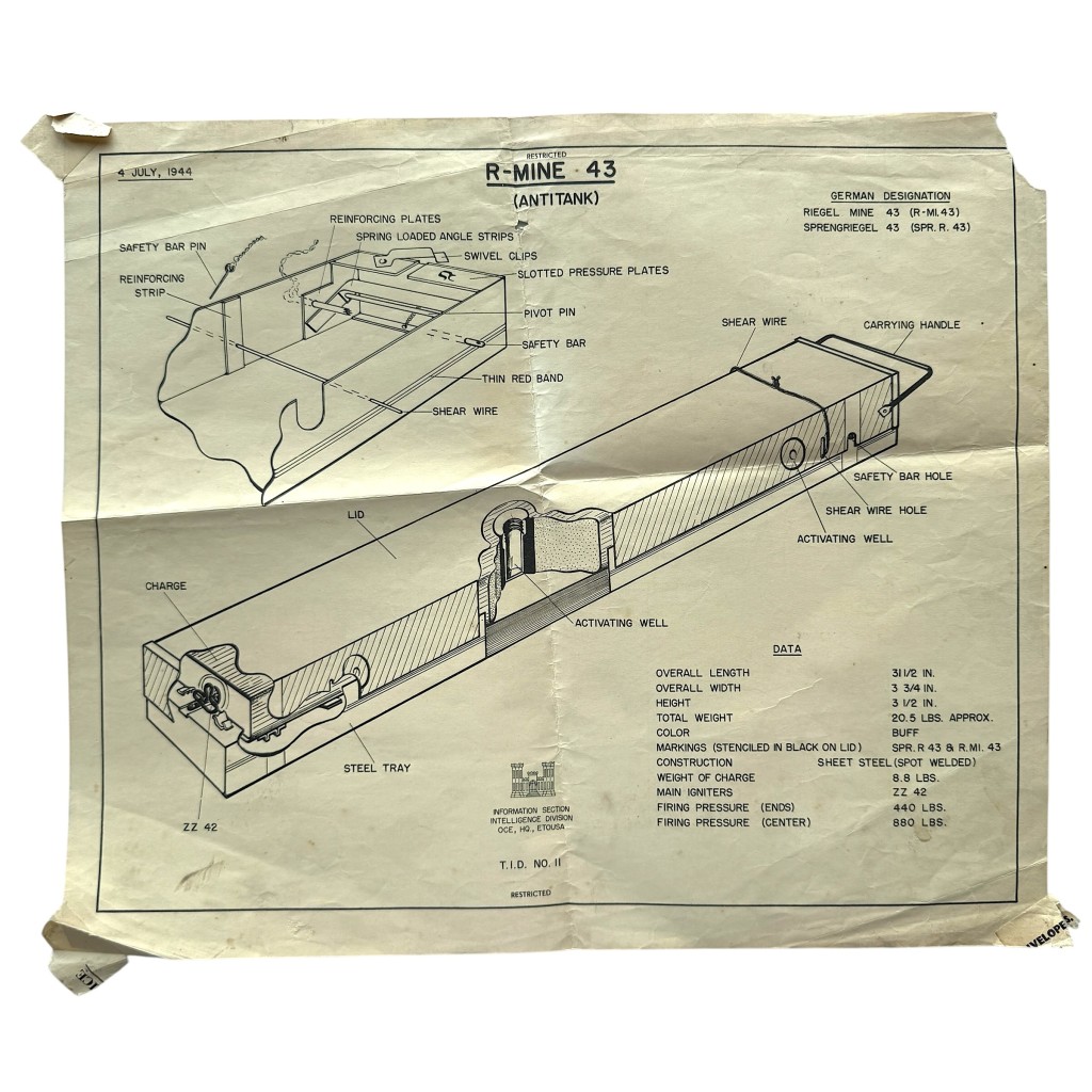
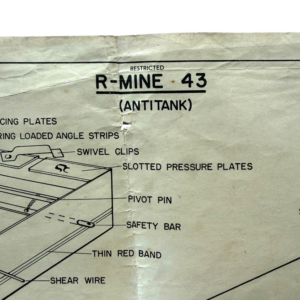
Original US Army instructional poster from the Second World War featuring technical information regarding the German R-Mine 43 anti-tank mine.
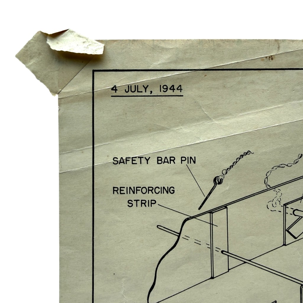
The poster is dated 4 July 1944 and was produced for military intelligence and training purposes.
The front displays a detailed technical cutaway drawing of the R-Mine 43 with descriptions of its components, construction features and technical specifications.
The R-Mine 43, also known by the German designations Riegel Mine 43 and Sprengriegel 43, was a German anti-tank mine widely deployed during the war.
The technical illustration includes information concerning dimensions, weight, igniters, explosive charge and pressure requirements.
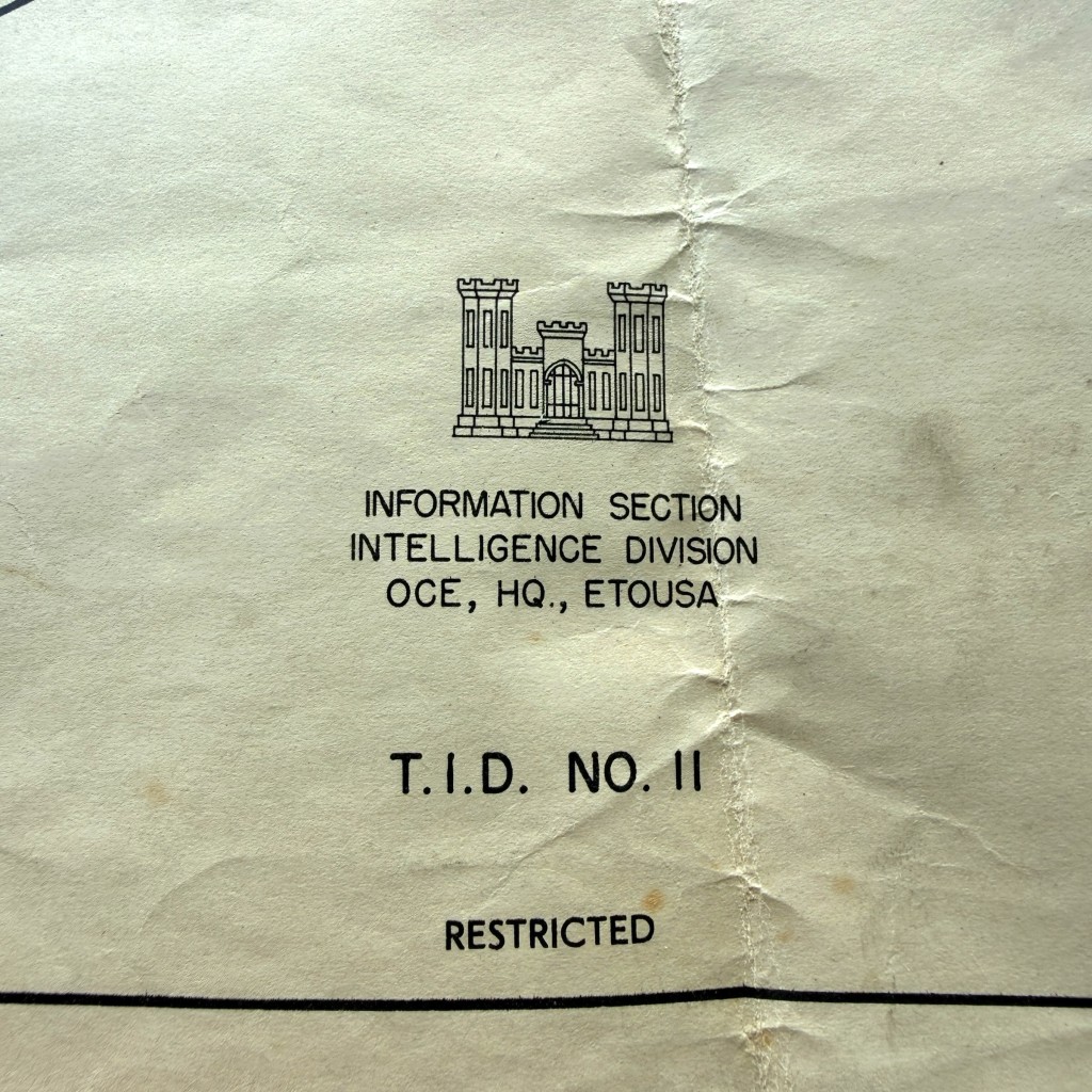
At the bottom appears the emblem of the Information Section, Intelligence Division, Headquarters European Theater of Operations.
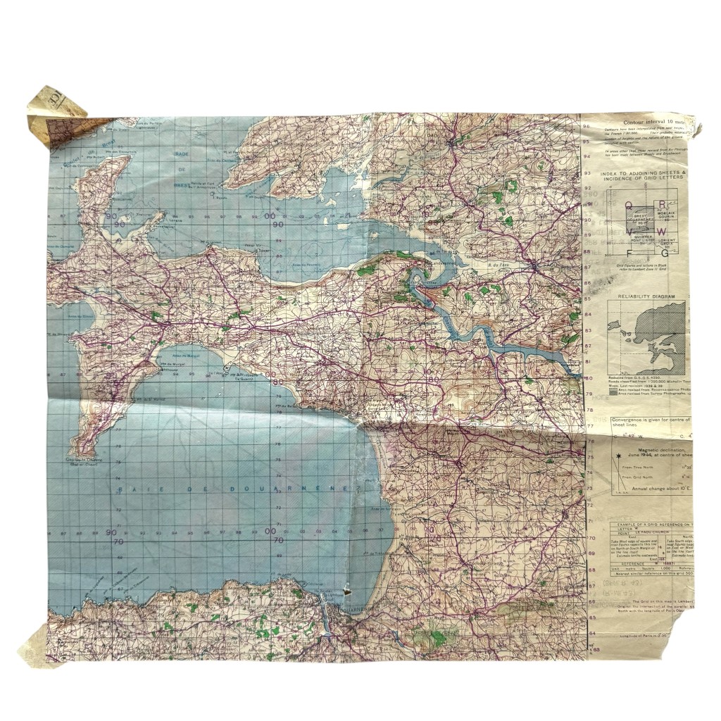
A particularly interesting feature of this example is that it was printed on the reverse side of a military staff map.
The map depicts part of the Brittany coastal region in France, including the areas around Brest, Crozon and the Bay of Douarnenez.
Such maps were used by Allied forces during preparations and operations in Northwestern Europe following D-Day.
The combination of a technical military training poster and an operational staff map makes this an exceptional collectible from the final phase of the Second World War.
Dimensions approximately 41 x 34.5 cm.
Article number: 19708
Originele US Army instructieposter uit de Tweede Wereldoorlog met technische informatie over de Duitse R-Mine 43 antitankmijn
De poster is gedateerd 4 juli 1944 en werd uitgegeven voor militaire inlichtingen- en opleidingsdoeleinden.
Op de voorzijde staat een gedetailleerde technische doorsnede van de R-Mine 43 met aanduidingen van de verschillende onderdelen, constructiekenmerken en technische specificaties.
De R-Mine 43, ook bekend onder de Duitse benamingen Riegel Mine 43 en Sprengriegel 43, was een Duitse antitankmijn die tijdens de oorlog op grote schaal werd ingezet.
De technische tekening vermeldt onder meer afmetingen, gewicht, ontstekers, explosieve lading en drukwaarden.
Onderaan is het embleem zichtbaar van de Information Section van de Intelligence Division van het hoofdkwartier van de geallieerde strijdkrachten.
Bijzonder aan dit exemplaar is dat de poster werd gedrukt op de achterzijde van een militaire stafkaart.
De kaart toont een deel van de kuststreek van Bretagne in Frankrijk, waaronder de omgeving van Brest, Crozon en de Baai van Douarnenez.
Dergelijke kaarten werden door geallieerde troepen gebruikt tijdens de voorbereidingen en operaties in Noordwest-Europa na D-Day.
De combinatie van een technische militaire instructieposter en een operationele stafkaart maakt dit een bijzonder verzamelobject uit de laatste fase van de Tweede Wereldoorlog.
Afmetingen circa 41 x 34,5 cm.
Artikelnummer: 19708
In stock