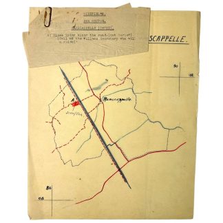
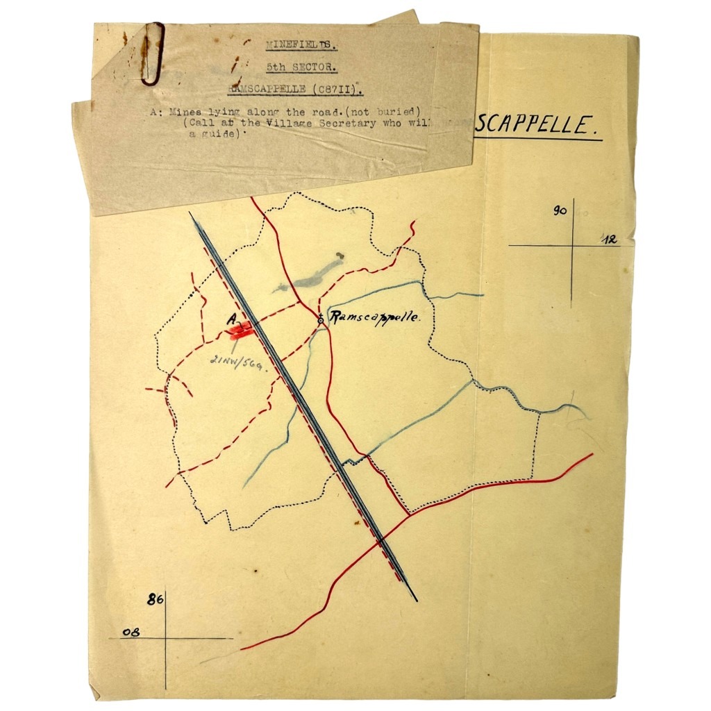
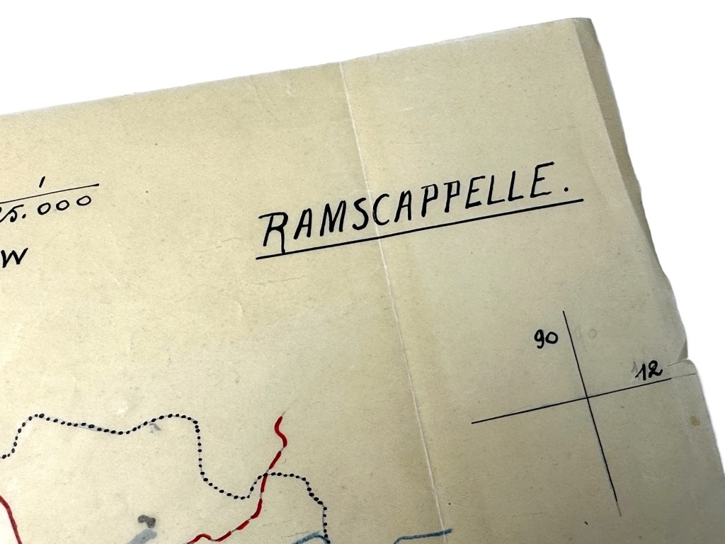
Original WWII US army minefield map of Ramskapelle in Belgium
75 €
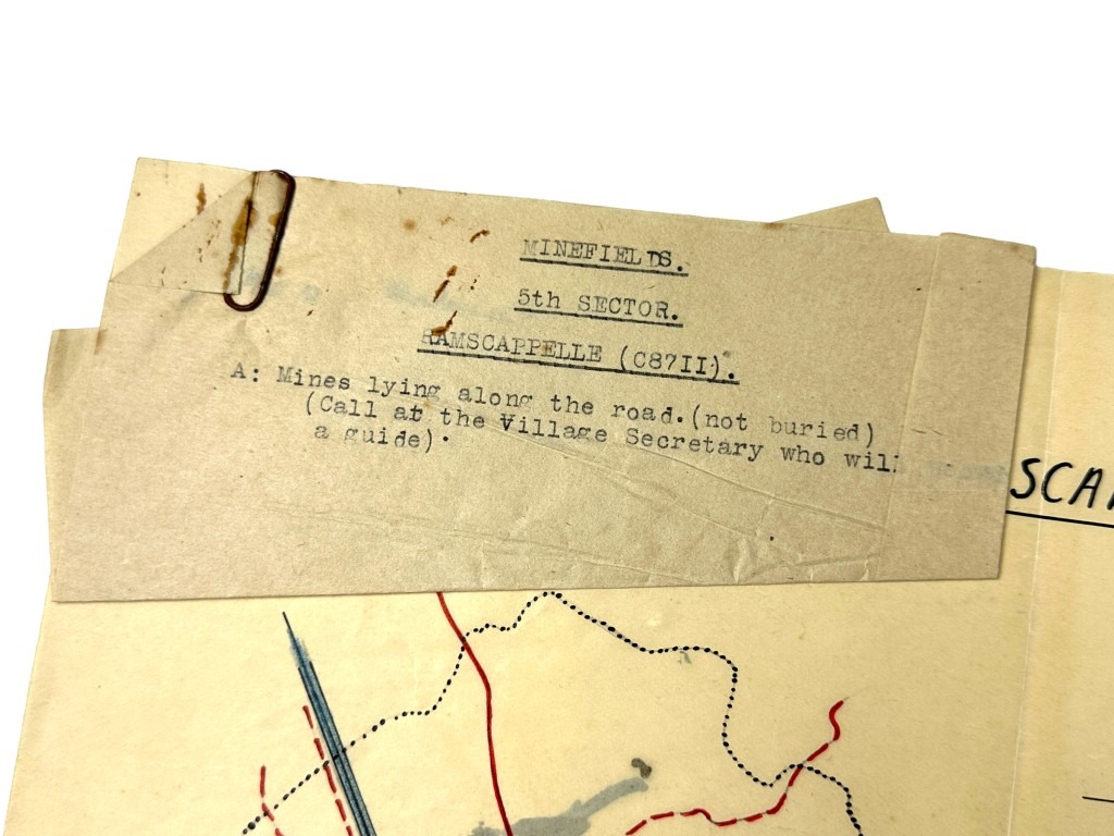
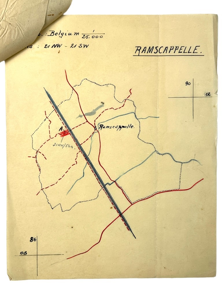
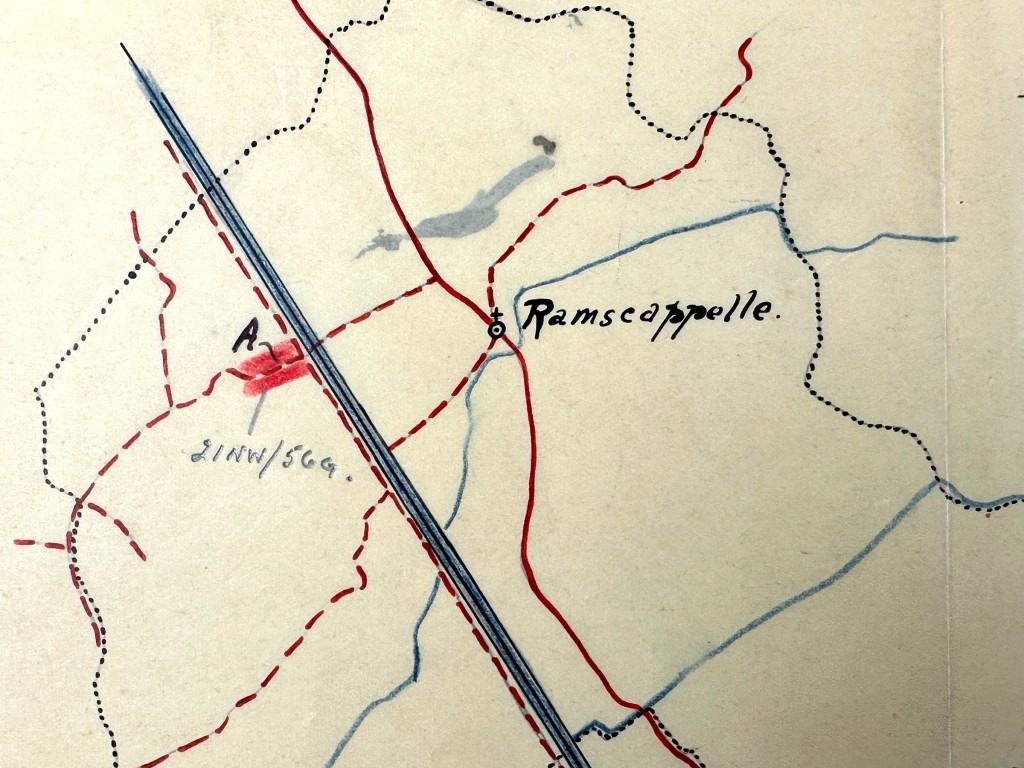
This US army map is in good condition and dates from late 1944/early 1945 and it shows a minefield in the town of Ramskapelle in Belgium.
Ramskapelle, a sub-municipality of Knokke-Heist in West Flanders, endured the same harsh reality during the Second World War as many other villages along the Belgian coast.
In May 1940, after the German invasion, it came under occupation.
Because of its strategic location close to the sea, the area was incorporated into the Atlantic Wall, the vast defensive line constructed by the German occupiers along the Western European coastline.
In the polders and dunes, bunkers, gun emplacements, and other military fortifications appeared, which drastically altered the landscape and confronted the local population with a constant military presence.
In 1944, after the Normandy landings, Ramskapelle found itself on the frontline during the Battle of the Scheldt.
This battle was crucial for the Allies to gain access to the port of Antwerp and to break through the German defenses along the coast.
Canadian troops moved through the region and engaged in heavy fighting with German units that offered fierce resistance.
Shelling, destruction, and evacuations struck the village and its inhabitants, who finally witnessed liberation in the autumn of 1944.
Liberation, however, did not mean that Ramskapelle was immediately safe.
All across the region, minefields and unexploded ordnance remained, threatening both soldiers and civilians.
Allied maps from 1944 and 1945 show how mines were laid along roads and in the fields, sometimes not even buried, making movement extremely dangerous.
Only after systematic clearing operations by Allied units, often supported by local guides, was the area gradually made passable again.
This map recently turned up in a lot with other minefield maps from that period.
Unique for the regional collector or World War II collection!
Article number: 16427
Originele WWII US mijnenveld kaart van Ramskapelle in België
Deze Amerikaanse leger kaart is in goede conditie en dateert van eind 1944/begin 1945 en daarop is een mijnenveld aangeduid in de plaats Ramskapelle in België.
Ramskapelle, een deelgemeente van Knokke-Heist in West-Vlaanderen, onderging tijdens de Tweede Wereldoorlog dezelfde harde realiteit als vele andere dorpen langs de Belgische kust.
In mei 1940, na de Duitse inval, kwam het onder bezetting te staan.
Door de strategische ligging dicht bij de zee werd de omgeving opgenomen in de Atlantikwall, de enorme verdedigingslinie die de Duitse bezetter langs de West-Europese kust aanlegde.
In de polders en duinen verschenen bunkers, geschutsstellingen en andere militaire versterkingen, die het landschap ingrijpend veranderden en de lokale bevolking confronteerden met voortdurende militaire aanwezigheid.
In 1944, na de landing in Normandië, kwam Ramskapelle in de frontlinie te liggen tijdens de Slag om de Schelde.
Deze slag was cruciaal voor de geallieerden om toegang te krijgen tot de haven van Antwerpen en om de Duitse verdediging langs de kust te doorbreken.
Canadese troepen trokken door de streek en leverden zware gevechten met de Duitse eenheden die zich fel verzetten.
Beschietingen, vernielingen en evacuaties troffen het dorp en zijn inwoners, die de bevrijding uiteindelijk in de herfst van 1944 meemaakten.
De bevrijding betekende echter niet dat Ramskapelle meteen veilig was.
Overal in de streek lagen mijnenvelden en niet-ontplofte munitie achter, die zowel soldaten als burgers bedreigden.
Geallieerde kaarten uit 1944 en 1945 tonen hoe langs wegen en in de velden mijnen lagen, soms zelfs niet ingegraven, waardoor verplaatsingen uiterst gevaarlijk waren.
Deze kaart is recentelijk opgedoken in een lot met andere mijnenveld kaarten uit die periode.
Uniek voor de regionale verzamelaar of Tweede Wereldoorlog collectie!
Artikelnummer: 16427
In stock