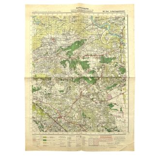

Original WWII German map of Ost ’s-Hertogenbosch
40 €
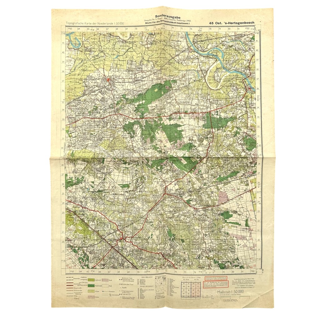
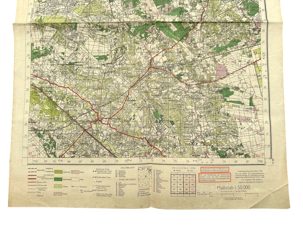
Original German military topographical map of ’s-Hertogenbosch and the surrounding area from the Second World War.
This map is sheet 45 East ‘s-Hertogenbosch and was issued in 1941 as a special military edition for use by German forces.
The heading states ‘Sonderausgabe’ and ‘Nicht für die Öffentlichkeit bestimmt’, indicating that the map was not intended for public distribution.
It provides a detailed overview of ’s-Hertogenbosch, Vught, Rosmalen, Berlicum, Uden, Schijndel and the surrounding region.
Produced in a scale of 1:50,000 and featuring extensive information on roads, railways, waterways, settlements, woodland and strategic infrastructure.
Maps of this type were used for military planning, troop movements and terrain navigation during the German occupation of the Netherlands.
Article number: 19833
Originele WWII Duitse stafkaart Ost ’s-Hertogenbosch
Originele Duitse militaire topografische kaart van ’s-Hertogenbosch en omgeving uit de Tweede Wereldoorlog.
Deze kaart betreft blad 45 Oost ‘s-Hertogenbosch en werd in 1941 uitgegeven als speciale militaire uitgave voor gebruik door Duitse troepen.
Bovenaan staat vermeld ‘Sonderausgabe’ en ‘Nicht für die Öffentlichkeit bestimmt’, waarmee duidelijk wordt aangegeven dat de kaart niet voor openbare verspreiding bestemd was.
De kaart toont een gedetailleerd overzicht van ’s-Hertogenbosch, Vught, Rosmalen, Berlicum, Uden, Schijndel en omliggende gebieden.
Uitgevoerd op schaal 1:50.000 met uitgebreide aanduidingen van wegen, spoorlijnen, waterwegen, bebouwing, bossen en strategische infrastructuur.
Dergelijke kaarten werden gebruikt voor militaire planning, verplaatsingen en terreinoriëntatie tijdens de Duitse bezetting van Nederland.
Artikelnummer: 19833
In stock