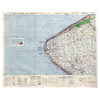
Original WWII British secret battle map of Westkapelle in Zeeland in preparation for the Battle of the Scheldt
400 €
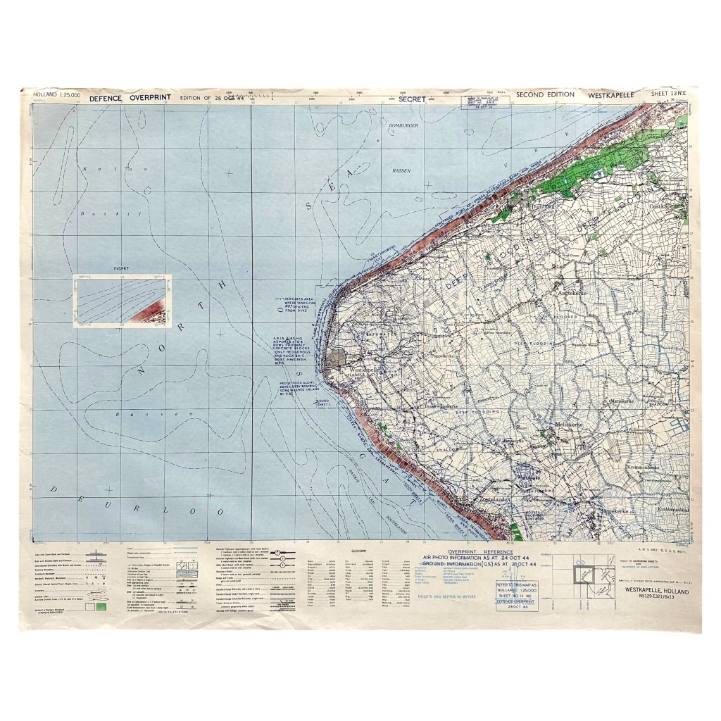
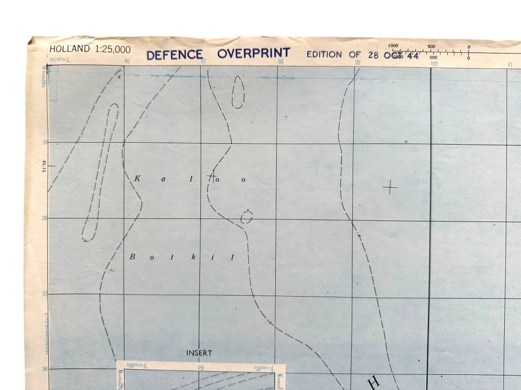
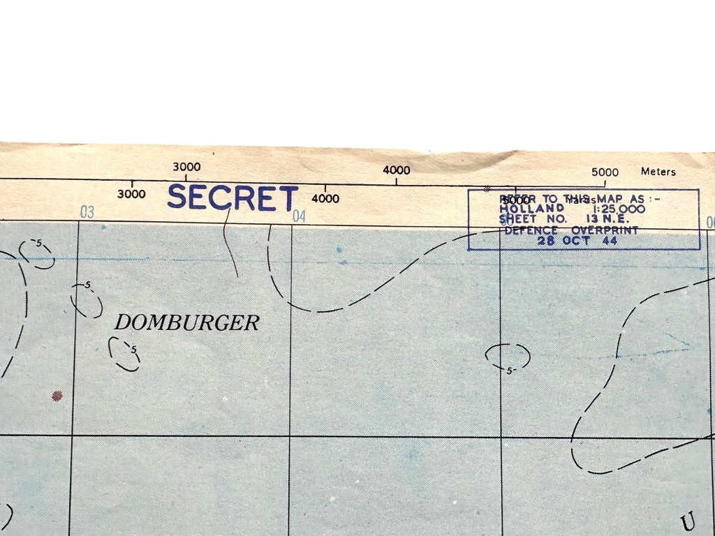
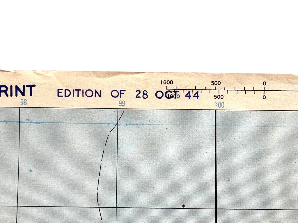
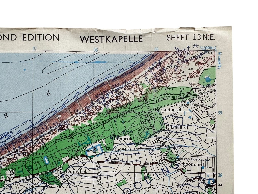
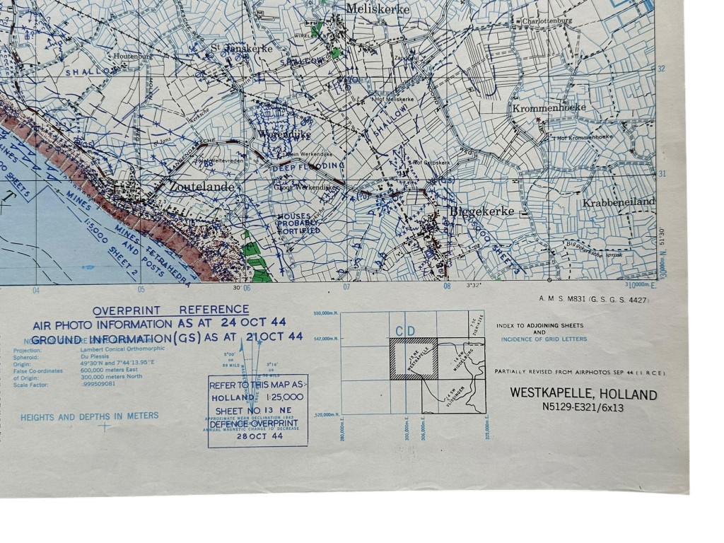
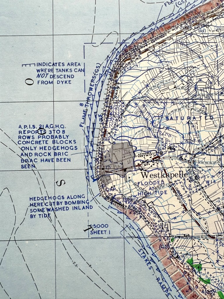
Original British Defence Overprint secret WWII battle map featuring detailed military information of Westkapelle in Zeeland in preparation for the Battle of the Scheldt.
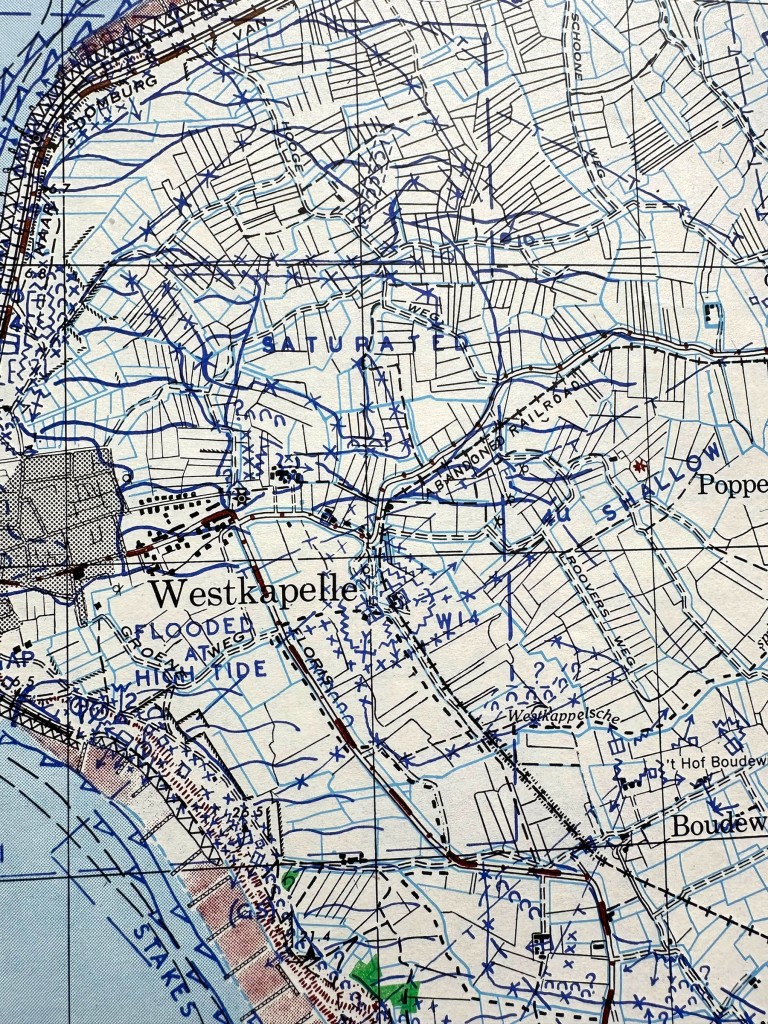
This military map was issued on October 28, 1944 and displays German defensive positions, coastal defenses, flooded areas and strategic locations around Westkapelle.
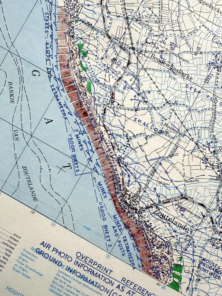
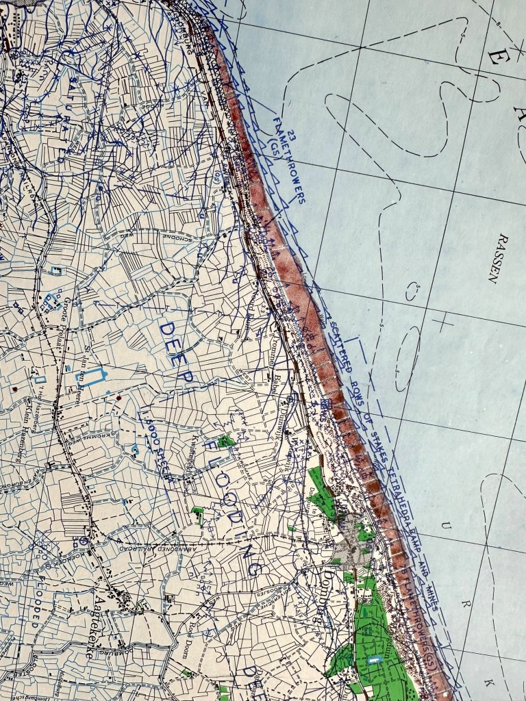
In addition to Westkapelle, the map also features locations including Zoutelande, Domburg, Aagtekerke, Meliskerke, Biggekerke, Poppenkerke and Oostkapelle.
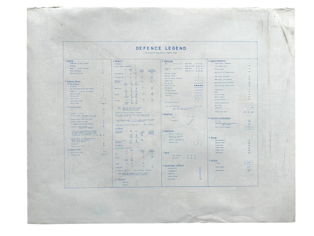
The Defence Overprint marking refers to additional military information specially added for Allied operational use during preparations for military operations in Zeeland.
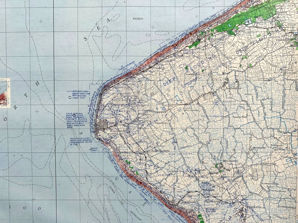
The map displays several military defense positions including tank obstacles, minefields, coastal batteries, flooded zones and locations where the specific marking “Flamethrowers” is indicated.
The map was used by Allied forces during preparations for operations required to clear the Scheldt estuary and open access to the port of Antwerp for Allied supply routes.
Westkapelle played a vital role because of its heavily fortified German coastal defenses and strategic location along the Zeeland coastline.
The landing at Westkapelle on November 1, 1944 became a decisive moment in the liberation of Zeeland and the reopening of the Scheldt for Allied shipping.
This original military map holds exceptional historical importance for collectors of WWII militaria, wartime maps and Battle of the Scheldt documents.
This rare map is especially interesting for a Zeeland World War II related collection or for collectors specializing in the Battle of the Scheldt.
Size: 62,5 x 50 cm.
A remarkable collector’s item featuring detailed wartime references and military information from one of the most significant Allied operations in the Netherlands during World War II.
Article number: 19404
Originele WWII Britse Defence Overprint geheime gevechtskaart uit de Tweede Wereldoorlog met gedetailleerde militaire informatie van Westkapelle in Zeeland in voorbereiding op de Slag om de Schelde
Deze militaire kaart werd uitgegeven op 28 oktober 1944 en toont de Duitse verdedigingslinies, kustverdediging, inundatiegebieden en strategische locaties rond Westkapelle.
Naast Westkapelle zijn op de kaart ook plaatsen zichtbaar zoals Zoutelande, Domburg, Aagtekerke, Meliskerke, Biggekerke, Poppenkerke en Oostkapelle.
De Defence Overprint aanduiding verwijst naar aanvullende militaire informatie die speciaal werd toegevoegd voor geallieerd gebruik tijdens de voorbereidingen van militaire operaties in Zeeland.
Op de kaart staan diverse militaire verdedigingspunten aangeduid waaronder tankobstakels, mijnenvelden, kustbatterijen, overstroomde gebieden en posities waar specifiek de aanduiding “Flamethrowers” wordt vermeld.
De kaart werd gebruikt door geallieerde troepen tijdens de voorbereidingen voor de operaties die noodzakelijk waren om de Westerschelde vrij te maken en de haven van Antwerpen bereikbaar te maken voor bevoorrading.
Westkapelle speelde een cruciale rol vanwege de zware Duitse kustverdediging en de strategische ligging aan de Zeeuwse kust.
De landing bij Westkapelle op 1 november 1944 vormde een belangrijk keerpunt in de bevrijding van Zeeland en de openstelling van de Schelde voor geallieerde scheepvaart.
Deze originele militaire kaart bezit een uitzonderlijk historisch belang voor verzamelaars van WWII militaria, kaarten en documenten uit de Slag om de Schelde.
Deze zeldzame kaart is bijzonder interessant voor een Zeeland Tweede Wereldoorlog gerelateerde collectie of voor verzamelaars gespecialiseerd in de Slag om de Schelde.
Afmetingen: 62,5 x 50 cm.
Een bijzonder verzamelobject met duidelijke militaire details en historische referenties uit een van de belangrijkste operaties in Nederland tijdens de Tweede Wereldoorlog.
Artikelnummer: 19404
In stock